
by Michael Cohen
Key Takeaways
- Despite the severity of the current water crisis in the Colorado River and decades of management, research, and litigation, basic facts about the river, such as the exact number of people it supports, remain unknown.
- A detailed accounting of where and how we use Colorado River water must be prioritized.
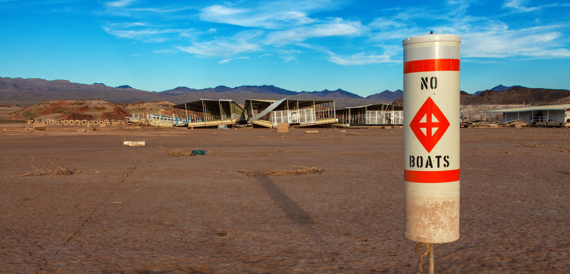
It’s all hands on deck for the Colorado River Basin. Nearing a quarter-century of drought (better described as a continuing shift to an ever-hotter and ever-drier climate), the most famous and important river in the West faces an existential crisis.
Seven months ago, the U.S. Bureau of Reclamation called on Colorado River water users to decrease their use by 15-30% — in one year. Without such extraordinary efforts, the two major Colorado River dams—Hoover and Glen Canyon—could lose their ability to produce hydropower in less than a year and a half. Even more concerning is that the continued decline of storage at Lake Powell could threaten the ability to pass water through Glen Canyon dam, diminishing flows through the iconic Grand Canyon and accelerating the decline of Lake Mead.
In response, farmers offer not to farm, cities pledge to conserve more water, and groundwater recharge operations forsake storing water underground, to compensate for the long-term overuse of supply, exacerbated by continuing decline of that supply. Simply put, every acre-foot of water matters to prevent the system from collapsing.
One might think that because the Colorado River is one of the most tightly managed and scrutinized rivers on the planet, we would have a detailed account of how every acre-foot is used and accounted for, how many people and users rely on the river, and where those uses take place. Yet, despite the severity of the current crisis and decades of management and research and litigation, basic facts about the river and the basin remain unknown, challenging efforts to better manage the system and avert the imminent crisis.
Water Use
Surprisingly, we do not know how much Colorado River water is used each year, especially in the Upper Basin. In the Lower Basin, Reclamation carefully measures releases from Hoover Dam and withdrawals to the Las Vegas metropolitan area – as well as diversion and delivery points downstream – but generally estimates unmeasured return flows[1] “by multiplying a water user’s diversion by an unmeasured return flow factor.” The volume of unmeasured return flows is only about four percent of total Lower Basin consumptive use but exceeds Nevada’s total use. The actual error here is likely very small, but it does suggest that the precision of Lower Basin consumptive use records exceeds their accuracy.
While the annual Lower Basin Decree Accounting reports enjoy broad credibility, Upper Basin water use accounting is much more challenging and less accepted. As Reclamation notes in its periodic Consumptive Uses and Losses report, the reliability of Upper Basin water use and loss estimates “is affected by the availability of data and the current capabilities of data evaluation.” Reclamation also notes that “Quantitative measurements of water use were used wherever available, but the majority of the basin water use was theoretically calculated. In the tributary areas of the basin, records of diversions and return flows are not complete enough to allow direct calculation of consumptive water use.” The Upper Colorado River Commission (UCRC) notes, “Historically, the Upper Division States (UT, CO, WY, and NM) have used multiple methods to estimate water use for irrigation, but these estimates were not consistent at an interstate scale that would be helpful to water managers and decision-makers, nor could the data be generated in a timely manner.” These sentiments reflect long-standing challenges to estimating flows past hundreds of different diversion points, as well as surface and sub-surface return flows. In June, the UCRC adopted a new method to measure agricultural consumptive water use in the Upper Basin.
Uncertainty about actual Upper Basin water use challenges efforts to quantify annual shortages. For example, Upper Basin decision-makers claim to have suffered from almost one million acre-feet (MAF) of shortages in 2021. But determining exactly where those shortages occurred, by how much, and the economic impacts of such shortages, is difficult. For example, the State of Colorado’s Division 5 (the Colorado River headwaters sub-basin) recorded 234 “administrative calls” (curtailments) in 2021, but the records do not include the volumes associated with these calls or whether those curtailed were able to divert their requested water at some later time.
Water Supply
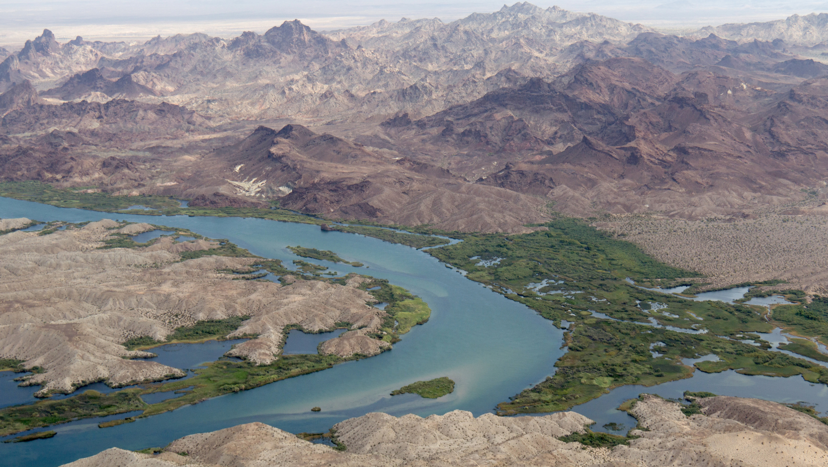
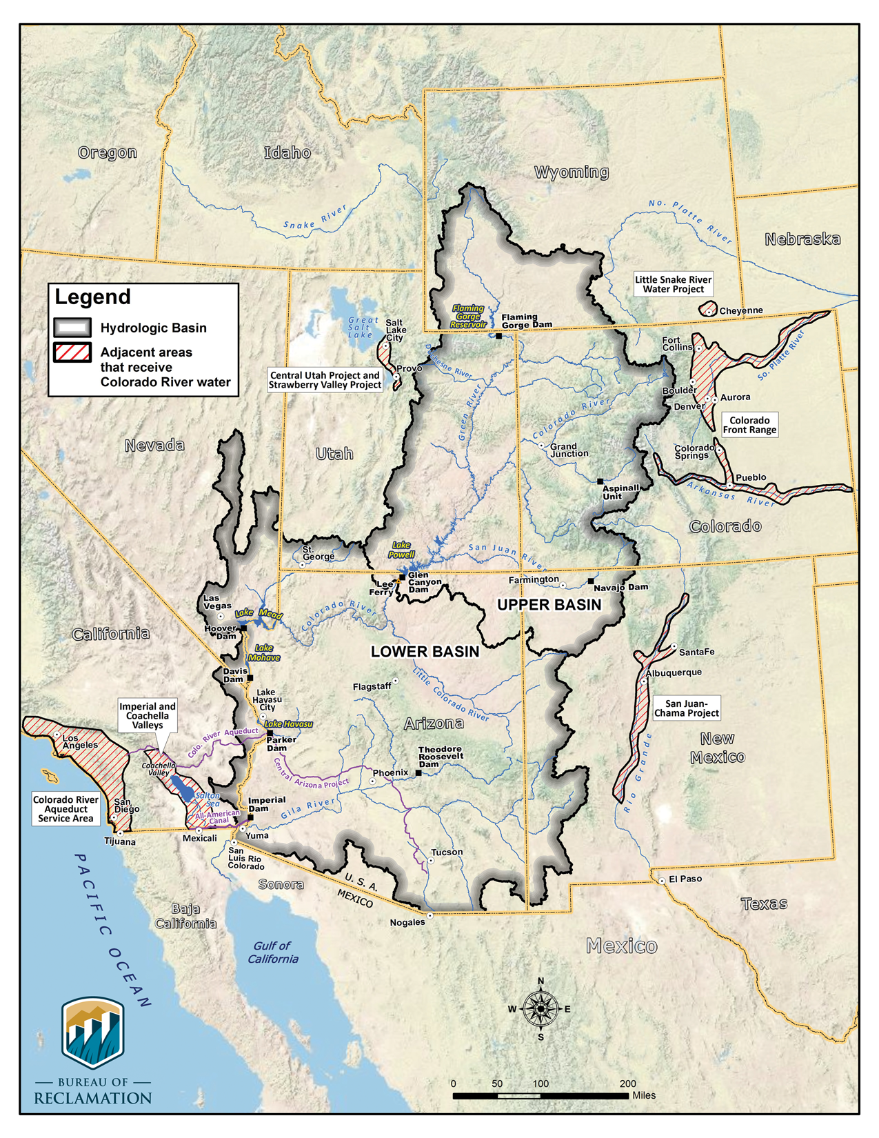
Many agencies estimate Colorado River flows and total water supply for the system, ranging from short and long-term snowpack and precipitation to “natural flows” and ‘’unregulated inflows.” One federal agency’s unregulated inflow forecasts account for physical factors such as precipitation and soil moisture and reservoir impacts (such as evaporation and change in storage) and measured (but not unmeasured) diversions, while Reclamation’s “unregulated inflows” account for both measured and unmeasured diversions. Reclamation estimates “natural flows” – the conventional measure of Colorado River annual water supply – based on Water Use (see discussion above) and its unregulated inflow forecasts, adding an element of uncertainty. Conventionally, Colorado River flows reflect an annual volume at Lee Ferry – the dividing point between the Upper and Lower basins, more than 765 river miles upstream from where the river used to meet the sea. Between Lee Ferry and Imperial Dam (630 river miles downstream), more than 1.2 MAF of “natural flows” would contribute to the river’s total discharge. That is, discussions about Colorado River supply typically ignore Lower Basin inflows that add another ten percent or so to the Lee Ferry volume – flow that is all consumed before the river reaches the sea.
Tribal Water Rights
The Colorado River basin is home to 30 federally recognized tribes, who have more than 3.2 MAF of recognized water rights. Twelve of the tribes still have unresolved water rights claims within the basin that could increase total settled tribal water rights well beyond 3.6 MAF. Recognition of unresolved water rights is long overdue and challenges efforts to estimate the location of future demands and uses as tribes develop their water rights and/or lease them to other users, again leading to significant uncertainty for Basin decision-makers.
Irrigated Acres
Colorado River basin water irrigates between 5 and 5.7 million acres of farm and ranch land – methods for measuring such acreage vary, and actual irrigated acreage changes year to year based on market conditions and water availability. A little more than half of the irrigated acreage exists within the hydrologic basin (though not within the institutional basin – see Basin Boundaries below). While new methods will improve understanding of both the extent of irrigated acreage and the amount of water used, we still don’t have a credible number for the number of acres irrigated within the basin, acres irrigated with Colorado River water that lie outside the basin, or the acreages of different crops. As we noted in our 2013 report, “the various agencies that report water and land use information for the Colorado River basin use a host of different terms that are often not comparable. The frequency and timing of many of these measurements are rarely synchronized.” It is important to be explicit here—for the sector that uses 70-80% of the Colorado River’s supply, we do not have a detailed understanding of just how many acres of agricultural land are irrigated with that water. As far as we know, no one has attempted another comprehensive accounting of irrigated acreage since our 2013 report, which seems long overdue.
Population
Conventionally, 40 million people use Colorado River water, an estimate from a 2012 report. But a decade later, we’ve learned that nearly seven million people in Southern California thought to use Colorado River water lack any physical connection to the river – the plumbing simply doesn’t exist to deliver water to them. The conventional population estimates also mix direct use of Colorado River water (and its tributaries) with groundwater pumped from the basin. How many people actually use Colorado River water (or more accurately, water from the Colorado River basin)? Given the significant growth experienced and projected, we should know this number and we don’t.
Reclamation’s May 2015 Moving Forward report states “The total population served in these metropolitan areas is approximately 29 million, or more than 85 percent of the total population served with Colorado River water supply” (emphasis added). That is, Reclamation’s 2015 report – based on population estimates submitted in most cases by municipal water providers themselves – suggests that about 34 million (=29/85%) people in the U.S. received water from the Colorado River basin. But that population estimate includes 18 million in MWD’s service area.
MWD states that, currently, about 12.3 million in its service area use Colorado River water (of 19 million current total). That is, the 2015 Moving Forward report over-estimated the population served, by more than six million people in MWD’s service area who lacked any physical connection to the river. Since 2010, population growth in Arizona as a whole and in the Southern Nevada Water Authority service area has been about 2 million since 2010. Reclamation’s report also states, “Similar to the Basin Study, the scope of the Moving Forward effort is limited to the portion of the Basin within the U.S.” The Pacific Institute’s Municipal Deliveries report estimated that Colorado River water served an additional 2.9 million people in Mexico.
So: adding two million (AZ+SNWA) and more than three million in Mexico minus about six million in MWD not served to 29/85% (=34) gives about 33-34 million people currently served by water from the Colorado River basin. The total is probably higher than that given population growth in Mexico and in Colorado’s Front Range and in Utah’s Wasatch Front, but about 35 million people served would be a much better estimate than 40 million.
Basin Boundaries
Scope – boundaries – matter as we measure and attempt to manage elements such as water use, exports, and water demands. Reclamation’s traditional map of the Colorado River basin excludes a large portion of the river’s former delta and the watershed draining to that delta, because it is a terminal basin that does not return flows to the river, even though the river flowed there repeatedly via gravity over millennia. This means that the basin’s institutional and hydrologic boundaries are not the same and means that millions of acre-feet of water that flow via gravity to the former delta are considered “exports” from the system – and that hundreds of thousands of acres irrigated with this water are deemed outside of the basin.
Boundaries also confound population estimates, because exports to Southern California and Wasatch Front and Front Range water agency service areas have often been counted as contributing to the use of their total service area populations, even if the plumbing doesn’t exist to deliver that water or if only a few molecules of basin water actually enter the service area. (For more discussion on the importance of boundaries see this blog post.)
Operational Neutrality
Reclamation’s August 24-month study “most probable” projection of Lake Mead’s December elevation determines the shortage tier for Lower Basin contractors and for deliveries to Mexico and helps set the operational tier for coordinated reservoir operations for the following calendar year. The 24-month studies show the projected physical elevations at each reservoir. In 2022, the August 24-month study “most probable” projection put Lake Mead’s December elevation at 1040.78’, which would have triggered 0.2 MAF of reductions in California and more than a MAF of total reductions in the Lower Basin and Mexico.
However, because Interior took actions to protect the elevation of Lake Powell and reduced releases from Glen Canyon Dam in 2022 by 0.48 MAF, the projected physical elevation at Lake Mead no longer determines the shortage tier. Instead, Reclamation now uses a separate and unpublished projected elevation, modeling the elevation of Lake Mead “as if” the 0.48 MAF had been delivered (“The reduction of releases from Glen Canyon Dam in water year 2022 (resulting in increased storage in Lake Powell) will not affect future operating determinations and will be accounted for “as if” this volume of water had been delivered to Lake Mead”), to determine shortage tiers and reservoir operations. That is, what is actually measured at Lake Mead is no longer the value that determines actual management and operations. Until the 24-month studies include a new column showing “operationally neutral” elevations, they won’t reflect future shortage triggers for Lake Mead.
Conclusion
What does this all mean? It means that as we respond to the declining reservoirs and risks of falling below power pool in the next year and a half, decision-makers won’t be armed with accurate or precise data on where and how we can reduce demands, especially in the Upper Basin. It may be difficult to identify just how we can get to the 15-30% reduction in uses as demanded by Reclamation if we don’t know exactly how much water we’re using now. Every acre-foot matters. That demands a detailed accounting of where and how we use Colorado River water.
[1] Unmeasured return flows are defined as “Mainstream water that has been diverted and which flows back to the Colorado River or the Colorado River Aquifer as measured or unmeasured flow and is available for use in the United States or in satisfaction of the Mexican Treaty Obligation”.